The Far North

Walks have been walked but not described here, on this blog, which is naughty because walks of such excellence need sharing.

Caithness might be anticlimactic for North Coast 500 drivers who just want to turn the corner at John o’Groats, but there is plenty to see for anyone prepared to leave the trade route. It’s gorgeously wild.

Underfoot conditions are taxing. The best places have no paths, just many square miles of tussocky grass, heather and bog. Good wild pitches are few and far between. Inevitably, when found, they turn out to be scenic.

The coastal cliffs are spectacular and the small mountains inland have far-reaching views because of the way they rise out of a low-lying bog. I could see the Cairngorms, Orkney and Assynt from more than one of the hills. The views justify the collar work.

The John o’Groats Trail

Volunteers are constructing a trail along the coast from Inverness to John o’Groats. The Trail will allow End to End hikers to avoid road walking in Caithness as well as opening up spectacular scenery to those of us with lesser ambitions.

The Trail is not a path. Where landowners have given permission, stiles are being built but the underfoot conditions offer slow going. Tussocky vegetation and cows with calves in summer mean that the Trail is best undertaken in early Spring. March, when days start to lengthen, might be best.

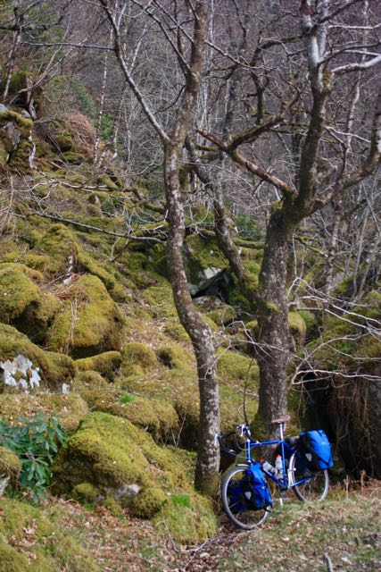
Last weekend, I hiked the final two stages, from John o’Groats back to Wick, thoroughly enjoying myself in the process. My first wildcamp of the year also took place.

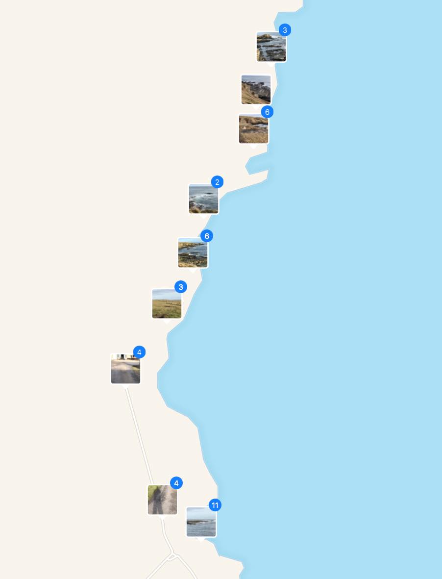
John o’Groats was much nicer than I remembered and surprisingly busy for April. Several other groups were hiking towards Duncansby Head and, at the Bay of Sannick, a man was flying a drone. He was photographing a seal from a respectful distance but the seal was fascinated by the drone and craned its neck for a better view.


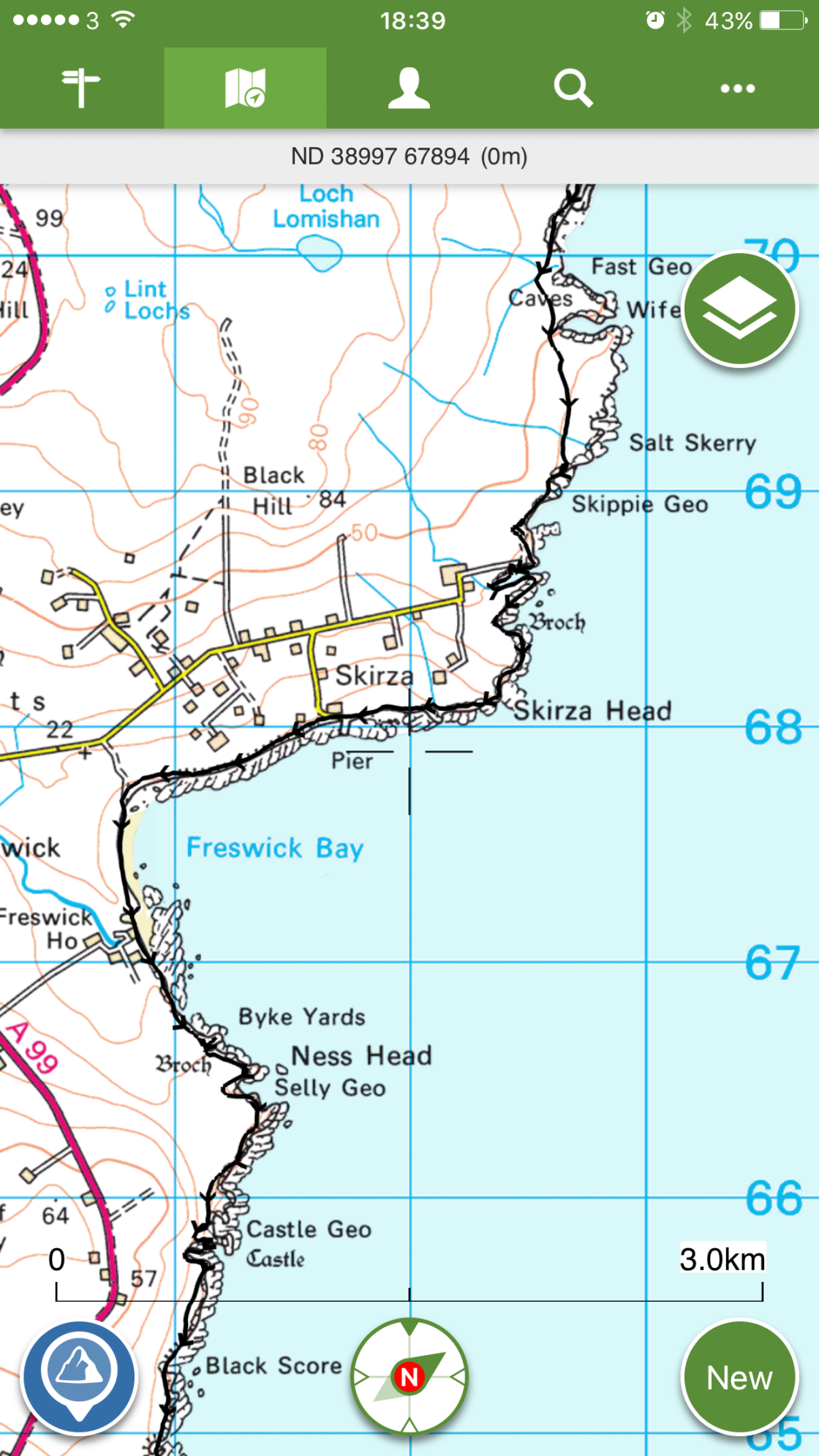
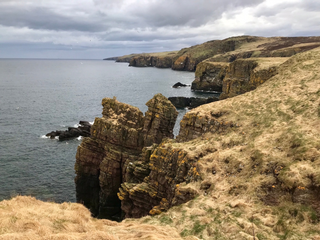
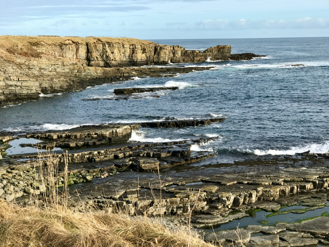
Once past the Stacks, I left other walkers behind and headed along a path through heather over the Hill of Crogodale to Skirza. A road up from the quarry at Skippie Geo offered an alternative to the Trail. I’m not entirely convinced that my conscientious line to Thistly Hill was rewarded. To be honest, the Haven of Skirza was a bit of a let down.

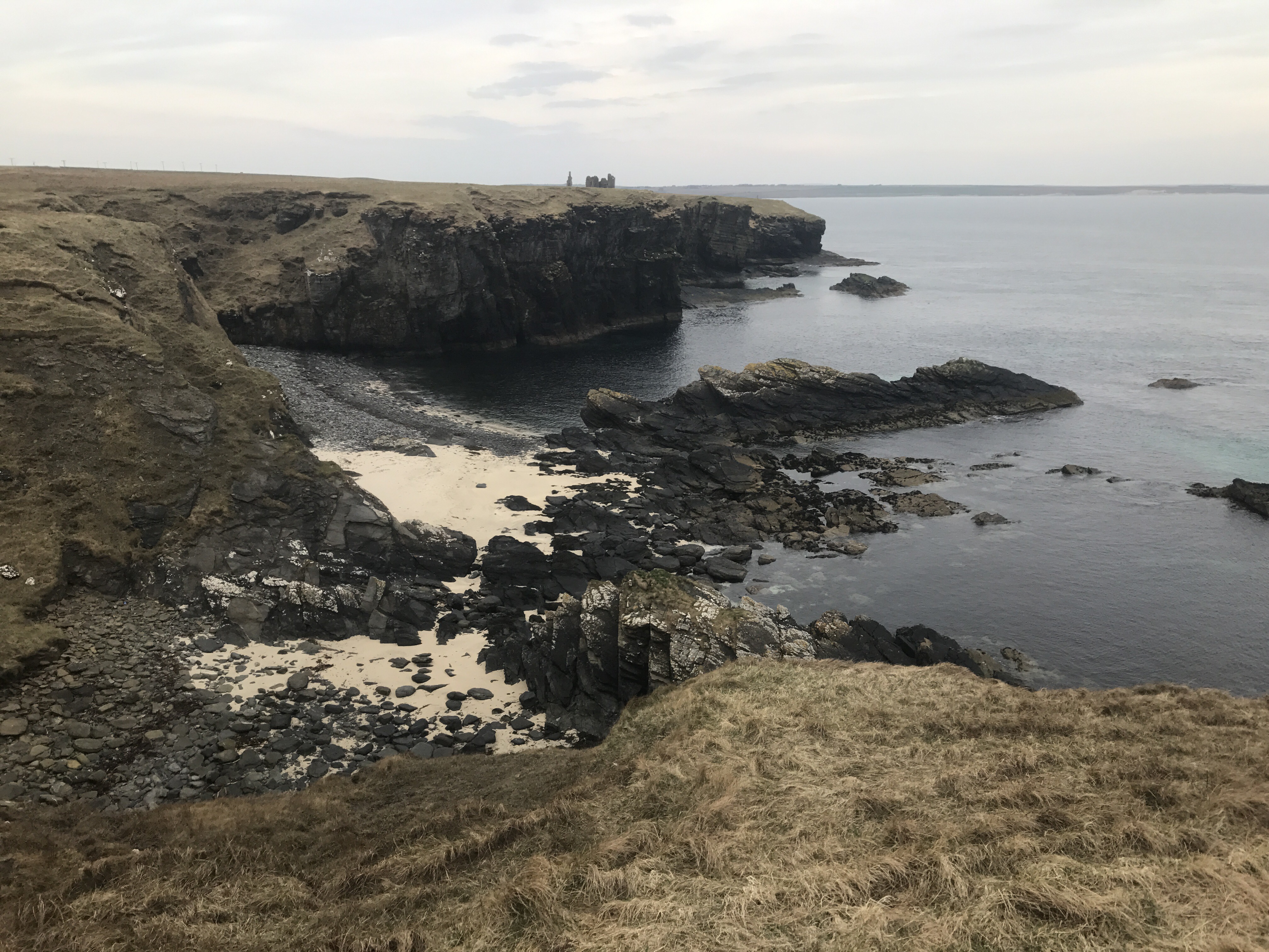
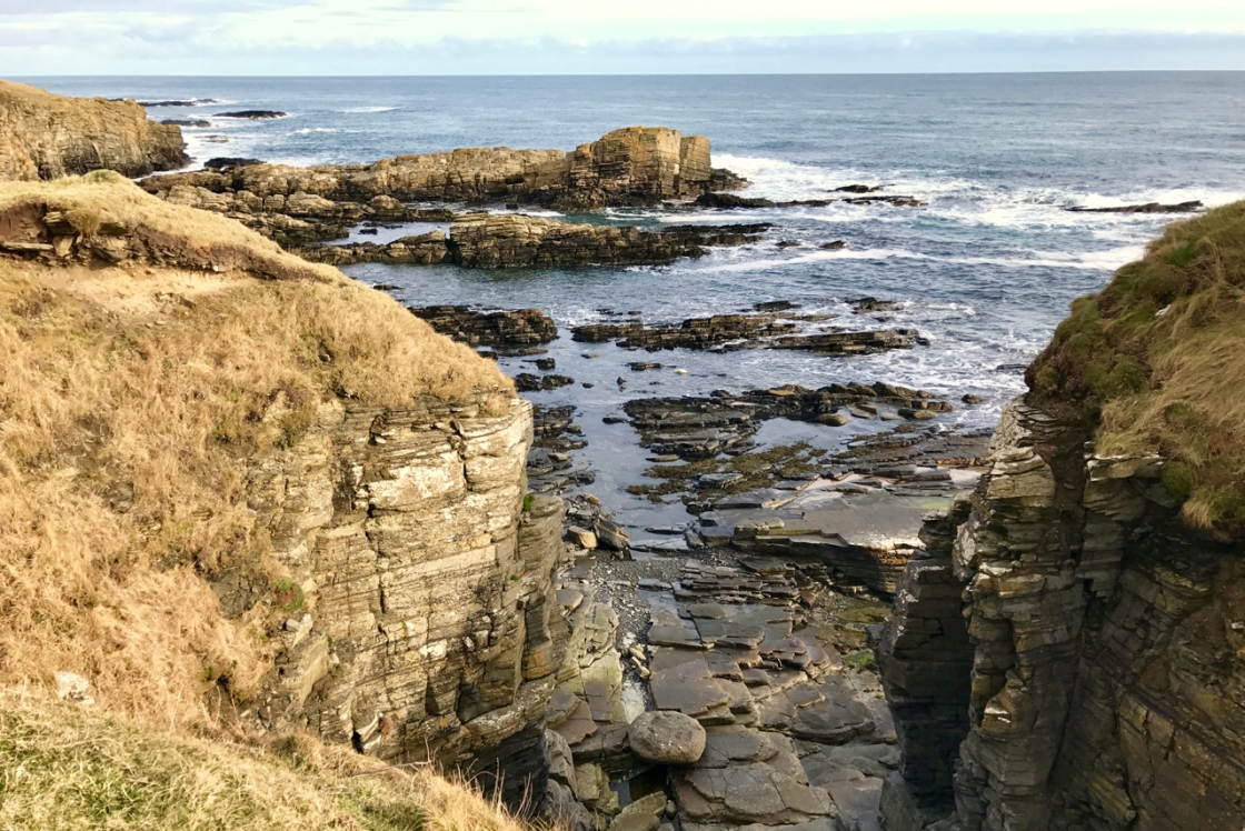
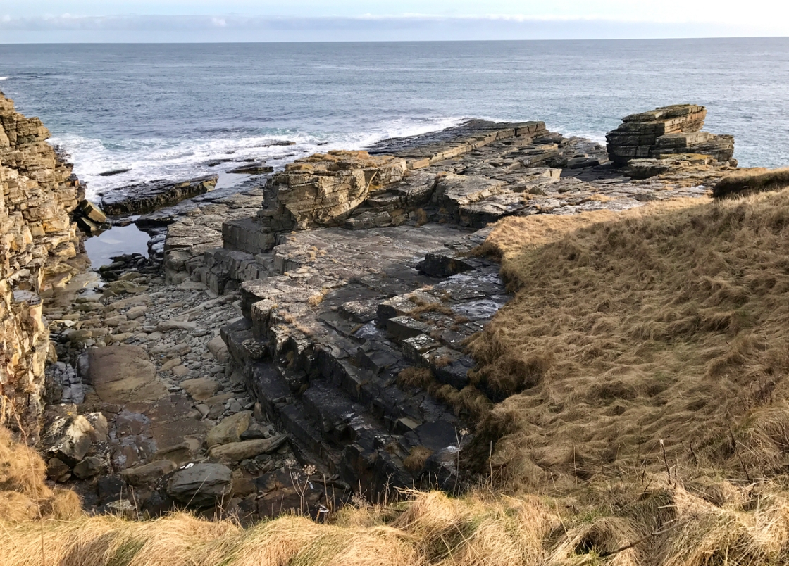
The lovely sands of Freswick Bay soon restored my spirits. Then the scramble by the mill at Freswick Mains gave a fun introduction to the next stretch of cliff, which has more than it’s fair share of ruined castles and brochs. It’s not a stretch to rush, which is a good job, because you can’t. Even in Spring, the vegetation makes walking a slow process. In fact, at Bucholly Castle, I was quite tired and gave some thought to pitching.

Just 9 miles in, I couldn’t bring myself to stop. As the best pitches were not quite flat, not quite dry and not quite out of sight, pressing on was the best option. A pork pie and a cinnamon bagel gave me the energy to continue.

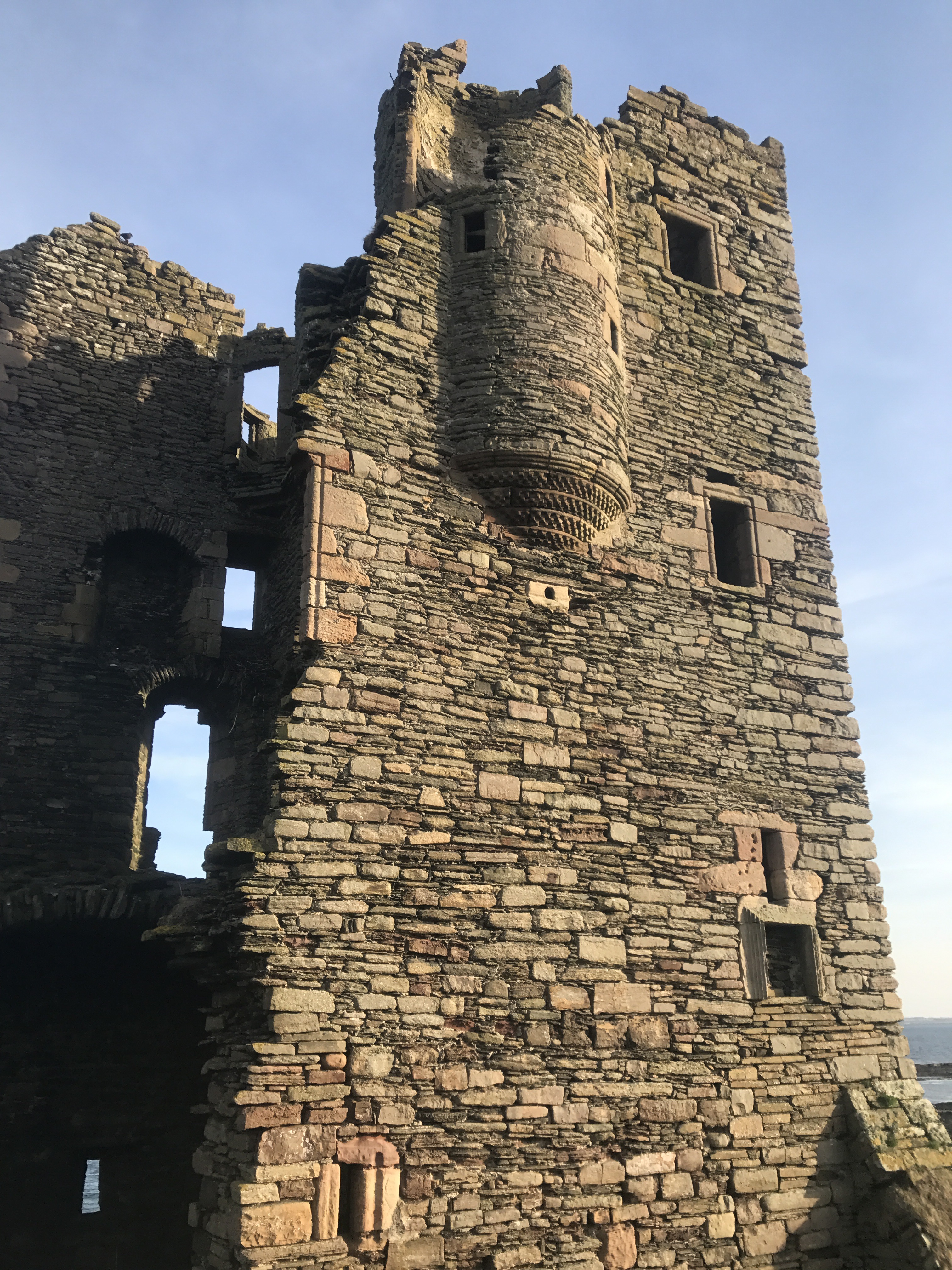
After a messy corner next to a pig farm, the Trail eased and was very pleasant in front of the houses at Auckengill. This harbour, unlike Skirza’s, is a visual treat and, fanfare, there is a short path along to the Mervyn Tower monument and broch. More slow going near the quiet, main road led to the spectacular, cliff top ruins of Keiss Castle.


After two more brochs, I reached Keiss harbour, with its big, stone breakwaters and pretty, little boats. The old warehouse appears to be flats now. I didn’t look closely. Instead, I climbed the stairs up to the village green and made a complete hash of finding the path back to the beach. As my route was dreadful, I won’t describe it.

My excuse for the error was concern about the River of Wester. Tide out – it’s ankle deep. Tide in – chest deep. The tide had turned so, once on firm sand, I motored along Sinclair Bay. The bay is spectacular and popular. Walkers could be seen in small groups right along the 3 miles of sand. I hurried past all of them and paddled straight through the river without needing to roll up my trousers.

Wick golf course looks a dream campsite and the clubhouse was closed but I had a sweeter, wilder pitch in mind so on I went. Through a field with sheep that followed me, by two camper vans at the end of a long, dirt track, past the very posh Ackergill Tower and into Ackergillshore via a children’s playground.

The light was fading fast as I finally pitched on perfect turf above the silver sand of a bay popular with eiders. ViewRanger claimed my 32km jaunt had included 1400 metres of climbing even though the Trail had never taken me above 80 metres. I slept well.


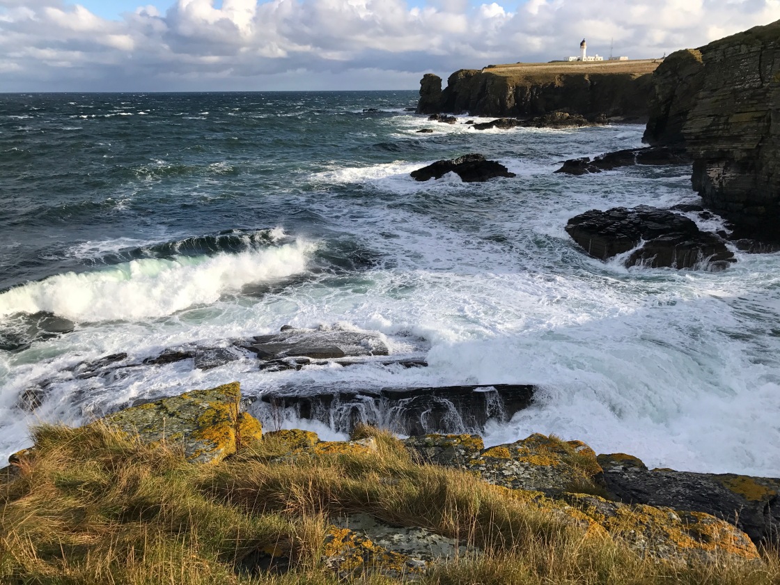
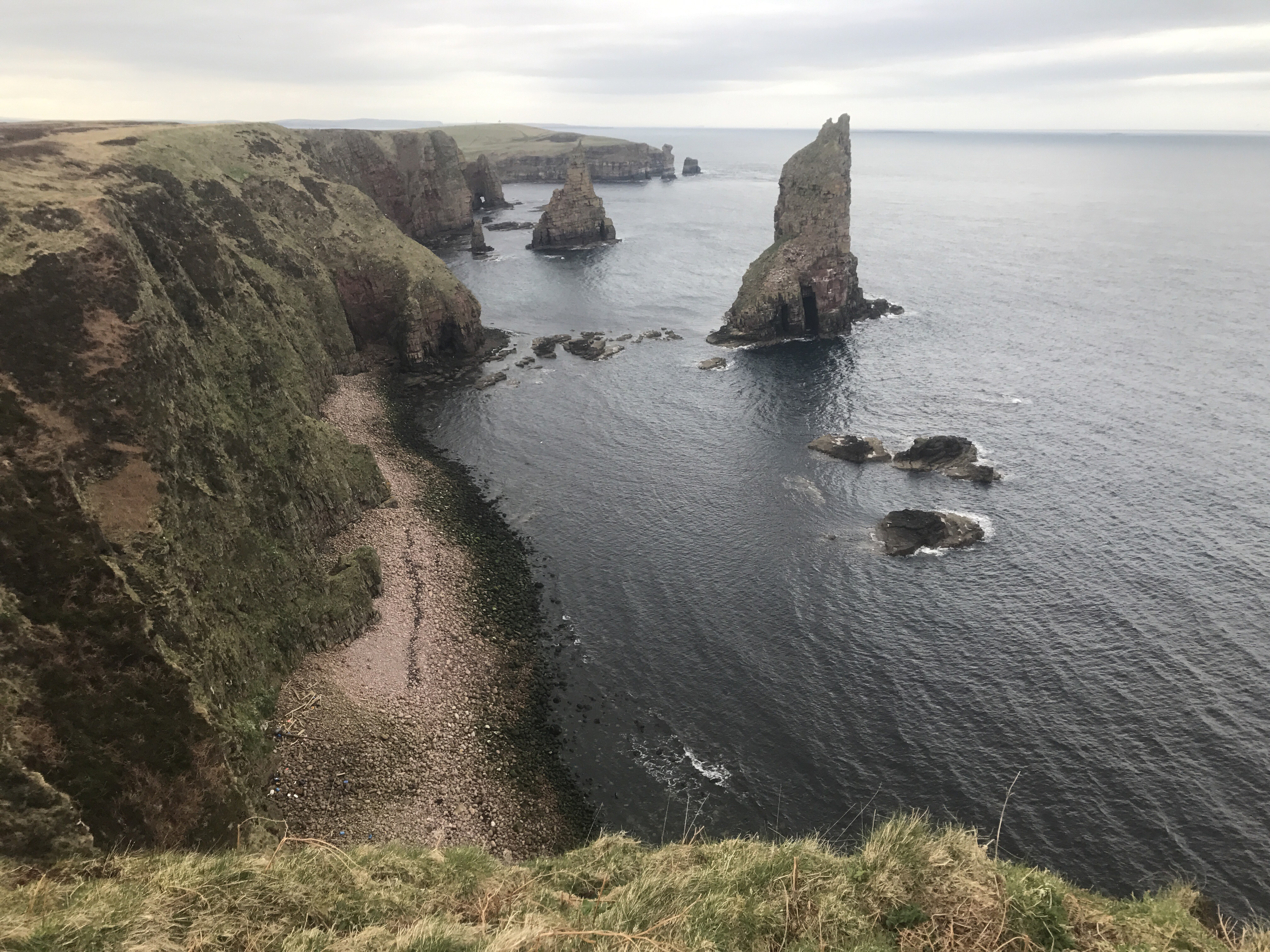
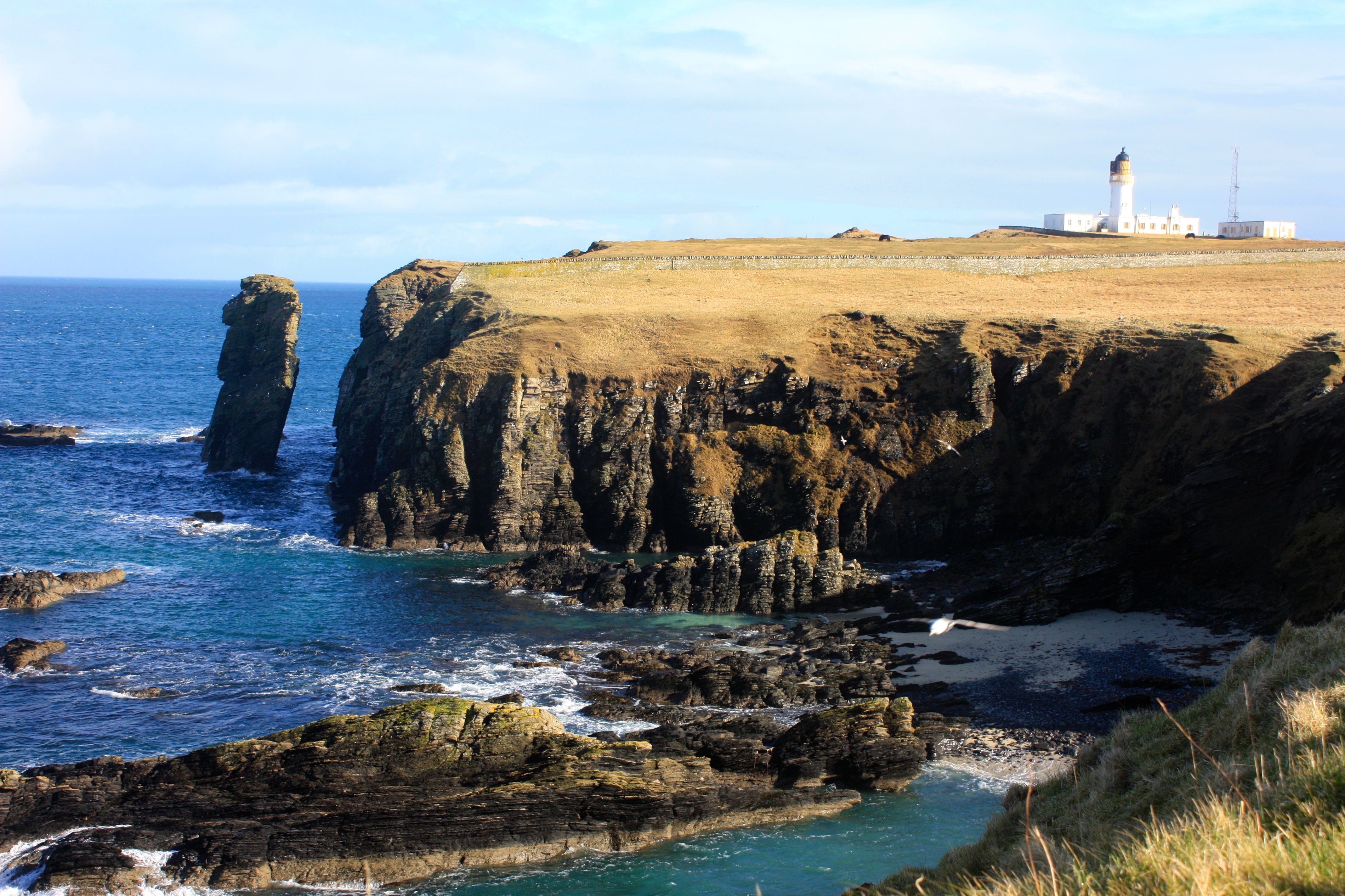
Next morning, my early start was rewarded with birdsong, notably from larks on land and eiders off shore. A short walk brought me to Girnigoe Castle and the best bit of the walk, around Noss Head. Numerous black guillemots added their squeaky whistle to the continuing bird chorus. Beyond the lighthouse, with all of the last stretch in view, I stopped for a second breakfast. While I enjoyed my final mini pie and bagel, a fishing boat clanked close by as a crab pot was lifted.

The alarm calls of oystercatchers and herring gulls around me suggested the birds here are more familiar with fishermen than with walkers. I hope the John o’Groats Trail encourages more walkers to enjoy this glorious coastline. My weekend hike was over but I’m giving serious thought to doing the entire Trail next year because the bits I’ve seen are excellent.

The Trail has its own website and WalkHighlands also has a complete description of the route. However, the most inspirational resource I’ve found is the Facebook page of Gavin Paul Bird. His Caithness Images, with drone footage of the Trail, are utterly seductive.

Filming with an iPhone 7 Plus

IMG_0334.jpg

Apart from enjoying a lovely morning, the aim of today’s hike was to find out how well an iPhone 7 Plus and a Gorillapod work together as a video filming set up for backpacking.  Sadly, I can’t show you the results as this blog doesn’t accept video so you’ll have to take my word for the acceptability of the product.  It’s plenty good enough for me and would look fine on YouTube.

IMG_0347.jpg

However, my interest lies in a set up for backpacking and there is a problem.  Filming on a cold day absolutely demolishes the charge in the battery.  Viewranger claims I was out for 2 minutes under 4 hours.  Filming occupied the first 3 hours and, in that time, the battery charge dropped from 100% to 21%.  For the walk home, I put the phone inside my jumper and listened to a podcast.  For this leg of the walk, the charge dropped from 21% to 20%.  So, for backpacking, the iPhone and Gorillapod set up would need to be used sparingly even though my Anker battery pack is pretty huge.

IMG_0340.jpg

The Gorillapod is part of the problem.  It’s head is stiff and not easy to deploy.  Getting the tripod out of a rucksack, attaching it to the phone and setting it up would be tedious enough to keep me from shooting video except when highly motivated.  Today, I kept the iPhone locked into the Gorillapod and held the phone in my hand.  The legs of the tripod lay along my forearm.  This set up was convenient and very easy to use but exposed the phone (and my hand) to the cold wind.  A permanently attached tripod could also be a problem if I chose to take a side trip up Suilven on my next hike.

discharging-an-iphone-2

I’m hoping my next trip will take no more than 5 days between power sockets.  Even so, discipline will be crucial.  Using my iPhone, a Gorillapod and an Anker power pack will get me the results I want so, failing a lottery win, that’s what I’ll be taking.


Morven and the Flows Nature Reserve

Ice on the tent in the morning and what looked like a good day.  My early start was soon halted  by a very boggy water course.  I managed to get across by stepping on stiff, rushy tussocks.  The small stream was almost completely hidden by a green carpet which offered nothing fit for standing on for quite a few square metres, rather like the bogs of Dartmoor.

Feith Fhuaran was the next obstacle.  My cowardly crossing of a stream too wide for jumping involved crawling on mossy boulders.  It worked.  A little later I reached the bealach between Morven and Small Mount.  My upward route wasn’t the best but clambering over large, conglomerate boulders is always entertaining.  The view of a great deal of not very much grew as I climbed.  I could see most of Caithness and most of what I could see was moorland.

morven ascent

The beginnings of a corrie give Morven a steep north face and a hint of a summit ridge.  My phone was suggesting four bars on the summit so I attempted texting friends but each text needed two goes at sending before it would whizz off into the ether.  My ascent route would not be the best way down so for the descent I headed east from the summit and then curved round the south side of the big hill.  This kept me on grass all of the way back to the haggy bealach.

Griams from Morven

I paddled through Feith Fhuaran on the return leg as my Inov-8 Roclites were wet through.  Grimpen Mire was tricky again.  After lunch, I packed the Akto and headed back towards The Glutt.  The track which had caused some difficulty the previous evening when I was shattered turned out to be easy with some sugar in my blood.  This time it was the estate road from Dalnawillan Lodge to Lochdhu Lodge which caused problems.  A dozen or more large, deep puddles stretched right across the sandy road.  At each, I had to dismount and carry my bike round.  However, after the spectacular Lochdhu Lodge, the surface improved and cycling became easy.

The Flows

My Anker power pack had gone flat because I used it to charge the phone while the phone was using GPS to track my route, a lesson learned.  I needed to recharge the huge battery and none of the camping looked great from the dirt road across the Flows nature reserve so I decided to make for a B&B in Forsinard.  Climbing Morven and cycling from Gobernuisgeach to Forsinard was a long day by my standards.  Another cracker, though.


First day nearly on the North Coast 500.

Quite why anyone would want to cycle the A9 when the remotest part of Caithness is blessed with many miles of fast dirt roads is beyond me.  I rode 46 miles of easy estate and nature reserve tracks getting to and from a wild pitch on the north side of Morven, the highest hill in Caithness.

Sadly, the quiet lane from Wick’s Tesco to Watten is currently closed for construction of a cable which will take electricity from the area’s many scenic windfarms to join the national grid in Macduff.  I had to use the Castletown road, which is busier.  Once at Loch Watten, I stopped for a snack and saw an otter.  It saw me and wasn’t phased at all.  The otter just carried on fishing.

North Coast 500 Day 1

At Westerdale my route crossed the Thurso river at a rapid.  I left the B870 on a narrow lane across a moor.  The lane passes a small cemetery and a lodge before turning to dirt at a car park.  Just a short distance along the dirt road, near Loch More, a white-haired man stepped round a Saladin armoured car with his arm out.  I suspect that if I hadn’t stopped he would have grabbed me and caused a pile up.  He asked where I was going.  As I was on a right of way, this was none of his damned business, but I decided to be polite.

He said a missile would be tested in 30 minutes.  I volunteered to wait if he was being precise about the 30 minutes.  He admitted he wasn’t.  He tried to persuade me to go a different way.  Only getting the map out persuaded him that there was no alternative.  Finally, he let me go after telling me repeatedly to stay on the estate road.  As I was riding a standard Thorn touring bicycle with 4 panniers, that was my intention.

Maybe 2.5km later I reached the targets, which were less than 3m tall and still being adjusted.  Whatever the missile was, and the white-haired man had been patronising when I asked, it was almost certainly intended for use against vehicles.

IMG_4473

So, having missed out on any explosive excitement, I passed the wreck of Dalnawillan Lodge and headed on for The Glutt, which appears to be the current heart of the estate.  The sandy road from The Glutt to Braemore is good for cycling but I was starting to tire.  The final stretch to Gobernuisgeach from Lochan nam Bo Riabhach, along parallel ruts in the heather, was troubling.  The bothy was locked and a gentle shower made the footbridge slippery.  After a mere half hour of low blood sugar faffing, the tent was up and a brew was on.

It had been a ride of incredible character across moors of a remoteness found in very few other parts of these islands.  The ride ended at a lovely wild pitch, miles from any other human.  The otter and the missile nonsense added to a day I am unlikely to forget.

Five stars.  Highly recommended.

The North Coast 500, sort of…

IMG_4462

For anyone who enjoys cycling along main roads, the North Coast 500 offers the best available in Britain.  The roads, apart from the A9, are fairly quiet and the scenery is glorious.

Sadly, the A9 features heavily and, at least in my opinion, the A835 between Contin and Garve is dangerous for cycling.  The north coast has been popular with camper vans for several years, some of whom should not be trusted with a moped.  The promotion of the North Coast 500 can only increase the number of rented camper vans in the area.

For those reasons, I decided to try my own version.  My version would avoid main roads when possible, as well as taking in Ardnamurchan and Dunnet Head.

Things did not go well.  My rear mech packed up and had to be replaced at the excellent Heaven Bikes in Ardgay.  The heaviest condensation I have ever seen finished off the autofocus of the kit lens which came with my Canon 450D.  Worst of all, a rapid change from cold, wet conditions to hot, dry terminally tore my dear, old, UV-damaged Akto.  The tin hat was put on things by a headwind battle from Craignure to Ardnamurchan, which trashed my quads.  I was clearly in no fit state for Bealach na Ba so I came home from the Kyle of Lochalsh for a half time rest.

IMG_4474.jpg

Despite that collection of difficulties, my holiday route has given some notable highlights, including

  • an otter sighting
  • a run in with some Qinetiq types, who had a missile to fire
  • 46 miles of dirt roads, instead of the A9
  • an ascent of Morven from a gorgeous wild pitch
  • a beautiful Sustrans route from Inverness to Ft William
  • gorgeous scenery around Kingairloch
  • the friendly but eccentric campsite at Craignure
  • the appearance of the wonderful Ardnamurchan Bunkhouse at my hour of greatest need

I’ll write the route up properly after completing (presumptious of me!) the second half of the route.  My quads have recovered and the slight bout of Spring knee pain has eased.  It’s time to get back on the road.

IMG_4510.jpg


Fresh eyes

Experience is a bastard.  It takes all of the fun out of things.  I almost remember what backpacking was like before I knew anything.  I dimly recall a sense of adventure.  Nowadays, as long as my body doesn’t fail me, I’ll get to the end of a backpacking trip, largely because many kinds of prior knowledge have guided me to choosing the right trip.  Not knowing the outcome used to take long walks to a higher plane of experience than appears possible as I approach my dotage.  I miss that sense of adventure.

On my first trip to Wales, I saw a footpath sign pointing to a place called Llywbr Coehyddus.  Although it wasn’t on my map, I knew it was the right path.  At the other of the path, at the next road, a signpost pointed back to Llywbr Coehyddus.  I must have gone through the place without noticing.  A couple of hundred metres along the road was another signpost pointing to Llywbr Coehyddus but it wasn’t pointing to the first place of that name.  The penny dropped. Llywbr Coehyddus is Welsh for public footpath.

This trip, with an awful Campri external frame rucksack, which cut off the blood supply to my arms, took place in the days before I had heard of magazines such as Climber and Rambler.  Guide books might have existed but even if I had seen one, I would not have been able to afford it.  The cost of an OS map almost bankrupted me.  However, I got full value out of that map in the many, excited hours I spent poring over it and planning my holiday.

The third footpath sign in Welsh pointed me up to the wild pitch I had picked out on the map.  Bluet Camping Gaz heated my dinner and then it was time to bed down in my rectangular, hoodless sleeping bag, possibly from Woolworths.  After dark, a noise kept me awake.  I thought it had to be an animal, perhaps a hedgehog, scratching my tent.  Sleep was impossible so I got out to check. No animal.  I climbed back into my sleeping bag.  Thank goodness it’s insulation could not be compressed as I had never heard of sleeping mats.

The scratching noise started again.  I tried to sleep despite it, because I didn’t want to get out of my Marechal J3 again, but couldn’t.  Out I went into what was now a cold night.  Eventually, I found the culprit.  Juncus.  There is not the slightest chance that a rush could make me feel concerned for the survival of my tent with forty years more experience.

To an extent, hiking in a completely different environment can freshen the point of view.  There was a brief moment of shock when I realised that tramping in New Zealand often meant using a river as a path.  The first time a path took me into unavoidable water was in a swamp in the far north.  It was on the second occasion, in a real river, that I realised New Zealanders hike along river beds when the forest is difficult to penetrate.

New Zealand’s tracks spend a great deal of time in forests, with occasional, welcome forays over passes.  I became a bit bored and started racing along until the day Fergus Sutherland entered Dunedin Youth Hostel to offer a low price on a course with the Catlins Wildlife Trackers.  In a single weekend, Fergus and Mary taught me a new way of looking at the bush.  With wonderful, new things to find, I had fresh eyes once more.

Back home, the sense of adventure is harder to rekindle.  My ride through a remote nature reserve did so and I imagine introducing children to backpacking must do, too.  Taking risks might be an option if I was braver as not knowing what the outcome will be is crucial to real adventuring.  Not knowing.  How many times has someone said to me, “If only I knew then what I know now…”  How misguided!  Ignorance should be cherished.  Is it possible that the drive to learn about the mountain environment is what kept me returning to Snowdonia, the Lakes and the Highlands.  Has knowing taken away some of the pleasure?

If only I didn’t know now what I didn’t know then…


Cycle touring in Caithness

The dirt road eased round a gentle corner into the base of the next climb, giving the northerly wind a chance to hurl stinging rain into my right eye.  My left eye, sheltered by my nose and by glasses stayed open and kept me on track.  Near the top of the hill, the rain eased, raising hope that this was just another prolonged shower rather than a weather front, but then the rain returned with full force.  I became aware of water seeping through my cycling shorts.  Given how cold my wet legs felt in the wind, shorts probably weren’t the best choice for such a remote location in these conditions.

The dirt road eased round to the south west.  The northerly decided not to help and dropped.  I could have taken it personally but the rain stopped and the sun found a hole in the clouds.  Warm now, I unzipped my jacket.  The dirt road curved to the west revealing a rainbow opposite the sun.  As soon as my shorts had dried, the wind picked up, clouds closed in and rain returned.

The wind, rain, sun, rainbow sequence repeated itself throughout the day.  I was slightly surprised to find that a carcass in its seventh decade can take this sort of abuse and was shocked to discover that it was fun.  Some might argue that crossing the barren Flows National Nature Reserve in conditions poor enough for cloud to be down on the 280 metre high Sletill Hill isn’t a great idea but there is only one route in Caithness which should not be ridden and that is the A9.  Everything else marked on the map is fair game and likely to be excellent.

Thanks to an RSPB Forest to Bog project, many of the trees shown on my new map had gone missing.  Caithness isn’t short of bog but it is short of trees.  Given a northerly blasting me with rain, I couldn’t help wishing that the RSPB had gone for a Dull Forest to Diverse Forest option instead of the one they had chosen.  Does bog really bring greater biodiversity than boreal woodland?  Islands in the lochs I saw a few miles further on carried the vegetation natural for this part of the world – trees, not bog.

At Forsinain, I turned south on to tarmac.  This time the wind did the decent thing and blew me down Helmsdale then up over to Glen Loth.  The tarmac from Kildonan Lodge to Lothbeg is in worse condition than the packed sand of the road through Altnabreac and is so narrow that I had to lift my four-panniered tourer off the road for vehicles to get by.  However, the estate have fenced off areas of natural vegetation, making this a gorgeous shortcut.  Aspens rattled in the wind at the foot of the 300 metre climb from Craggie Water’s gorge.  The climb’s gradient is reasonable and the view from the top superb.  I eased my way down the other side.  Although the road surface had improved, the road held quite a few sheep and a surprising number of vehicles came towards me.

The day finished with three unpleasant miles on the A9 to a pitch on the well-cared for, little campsite just before Brora.  Wind and rain continued.  Next morning, I endured the A9 until The Mound, where a gorgeous lane heads over to Bonar Bridge.  More natural woodland and a fulmar in the road.  It ran and flapped ahead of me but failed to take off.  It stopped in a puddle and let me by.  I wasn’t sure how to help it, not least because of the trees hemming the road.  They say if you can catch a bird it will die and if you can’t, it might not.  Feeling slightly guilty and wondering whether fulmars can take off from roads, I pressed on without trying to catch it.

The lane climbed gently beside a pretty river.  After three miles the trees ended and I found myself in an open valley as the rain returned.  A little further on, a sign said that the road was closed after Loch Buidhe.  Why did they make me cycle uphill for the best part of four miles before telling me the road was closed?  Unimpressed, I decided to press on.

The lane is being resurfaced and workers, most standing and watching a JCB, were dotted along it for miles.  They didn’t seem to mind a cyclist coming by and one man, who was rebuilding a bridge on his own, helped lift my bicycle over two trenches.  Top bloke!  Soon afterwards, I was in Ardgay where this stage of my tour came to an end.  The route from Watten to Forsinain is superb and, apart from two teeth-rattling miles near Loch More, the sixteen miles lacking tarmac are fine on a road bike.  Winds willing, I’ll be back.

Noss Head from Wick

The North Head path out of Wick leads past interesting cliff scenery to a sewage works.  Just round the corner, looking over Broad Haven to photograph Papigoe, crowberry cushioned my feet.  Not the usual sea level vegetation.

Papigoe from North Head

Staxigoe has a pretty, little harbour.  Then barbed wire makes the next section of the cliff top walk look unpromising, but it relents at a soggy, sheep-messed nature reserve.  So far, I’m probably not succeeding in making this walk sound too interesting but I was enjoying myself and taking my time over the many bird watching opportunities as well as seal spotting and scrambles down to rocky coves.  At the back of each beach were huge, rounded pebbles.  Beyond, greasy ribs of dark rock ran out to sea.

A spiteful hail shower hit just before the Noss Head lighthouse but, once it had past, the afternoon weather improved.  The sun came out and the cold wind dropped a bit.

Noss

Two, friendly ponies live in a field by the lighthouse.  They are just visible behind the big wall in the photo.  Whoever built the end bit of the wall must have had an excellent head for heights.  A sandy beach has an old path leading down to it along with the remains of some bits and pieces for launching boats.  There are no houses nearby.

Sinclair's Old Castle

To be honest, restoration has not enhanced the ruins of the castle but its location is spectacular.  Large, oil support vessels sheltering in Sinclair Bay were too far out for my camera’s lens to deal with.  They were all facing in the same direction and it was not into the wind which suggests that the ebbing tide was moving quickly northwards.

Looking back to the castle

The road walk back from Ackergillshore wasn’t intolerable.